Sistemi di homeland security
Homeland Security: sistemi e soluzioni per la sicurezza integrata del territorio
Homeland Security will consider:
- New sensors.
- Existing sensors.
Data provided by all sensors must be used for data base generation and data fusion
Border security includes both land and maritime borders and transportation security, including aviation and maritime transportation
The border control system includes the following subsystems:
- Communications.
- Electronic Warfare and Intelligence (Elint, Sigint)
- Radar.
- Video surveillance.
- UAV and Manned platform.
- Command & Control
- Cloud computing platform
HOMELAND SECURITY SCENARIO
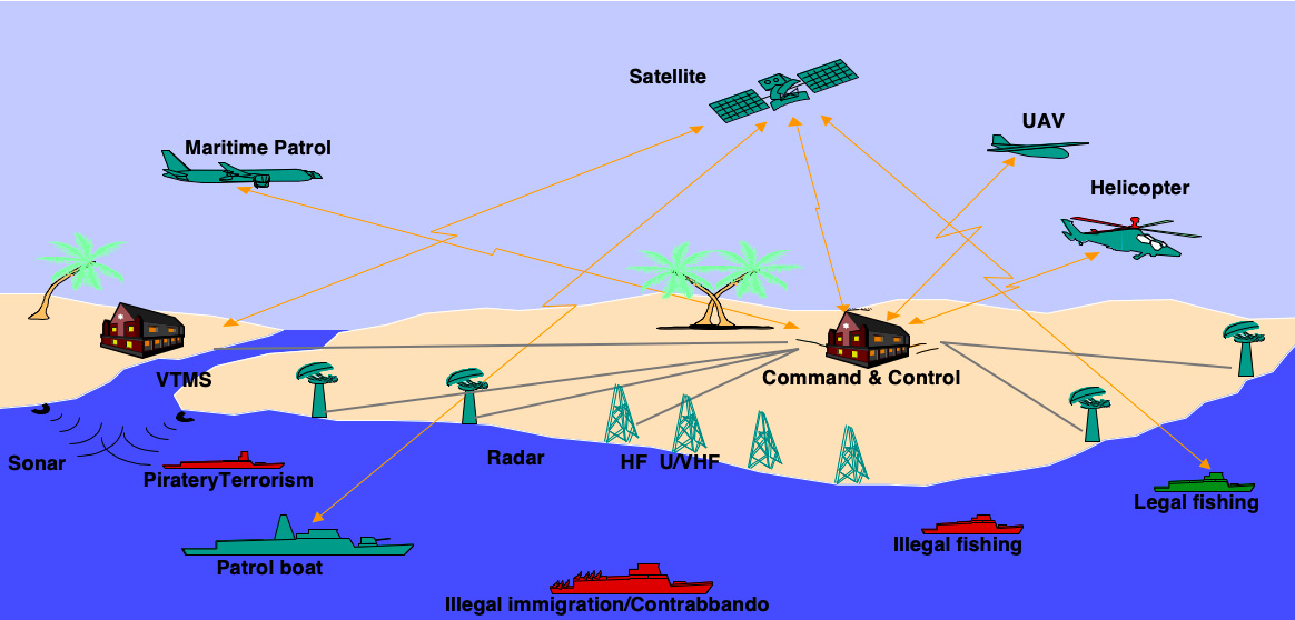
SURVEILLANCE AND HOMELAND SECURITY: TECHNOLOGIES AND CAPABILITIES
Sigma Consulting and its partners are engaged in different areas of HOMELAND SECURITY through the design and manufacturing of modern sensors and Command & Control S/W.
GEM elettronica’s dedicated engineering team has proven experience in site survey, system integration and logistics support to provide innovative solutions to government agencies, port/airport authorities and industries for the protection of critical infrastructures.
Our Company provides high-quality and reliable products and services to satisfy the needs and expectations of our customers for mission of:

COASTAL SURVEILLANCE

BORDER SECURITY

AIRPORT GROUND SECURITY

PIPELINES AND OIL PLATFORMS SECURITY

PERIMETER INTRUSION DETECTION SYSTEMS
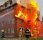
FIRE PREVENTION SYSTEMS
COMMUNICATIONS MANAGEMENT
C&C CENTRE
- C-SIGINT DATA : Ground, Mobile Stations, UAV
- GONIOMETER, HF, V/UHF DATA
- EQUIPMENT LIBRARIES
- FINE ANALYSES

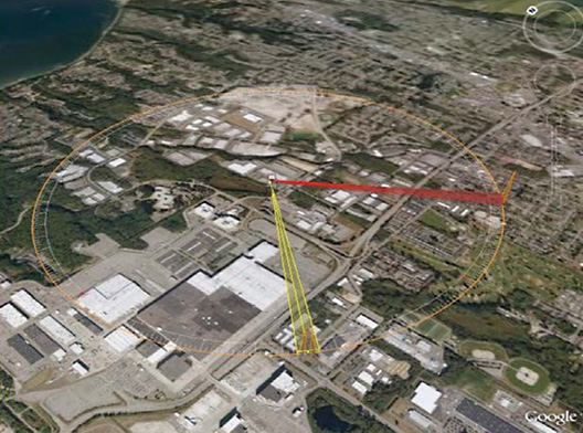
RF GONIO / COMINT) FOR UAV (ANTI- IED) and IDENTIFICATION trough Link with Ground Station
Advanced, wide-band, low size and weight, software-based localization system.
Precise goniometric interception capability and high sensitivity.
Main features:
- Detection of spread spectrum emissions
- Detection of ultra wide band emission
- Detection of signals under the noise threshold
- Super resolution algorithms for co-channel emissions
- Fast localization

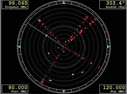
RF DIRECTION FINDING-COMINT MAIN FEATURES:
- Fast Radio goniometry localization
- Spread spectrum emissions detection
- Super résolution algorithms for co-channel emissions
- Wide band signals analysis
- Identification with emission library

COMINT LOCALIZATION
ELINT FOR UAV
- Advanced, low size and weight, software-based Elint system.
- Precise goniometric capability and high sensitivity.
- Radar emitters fine analysis
- Identification
- Localization
- Fine analyses on pulse trains on ground
ESM – RWR – ELINT
- Low cost, low weight (UAV application)
- 0,5 GHz – 40 GHz operation
- Modular: 4 to 8 antennas and receivers
- High traffic: more than 3 Mpulse per second
- Multimode ESM, RWR, ELINT, Multiplatform: UAV, aircrafts, satellites
- C/F dispenser management
MICROWAVE AND RF Facility
MICROWAVE AND RF SUBSYSTEMS Design and Development
- EW Receivers 40 GHz
- Radars
- Filters, Attenuators, Antennas
- SAR
- Phased Antenna arrays
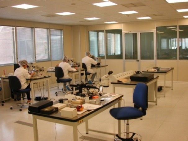
Clean Room - Class 100000
INTELLIGENCE COMMAND & CONTROL – MISSION SUPPORT CENTER
-
EW support
-
EW ESM/C&F Mission Libraries Preparation and Validation
-
EW Radar & Threats Database
-
Mission Vulnerability Assessment
-
EW Mission Replay Debriefing
-
EW ELINT Recording Analysis
INTELLIGENCE COMMAND & CONTROL


Avionic Platforms
- Pipelines monitoring: Gas, Petroleum, Chemical
- Ecological monitoring: Atmosphere (Weather), Air Pollution control, Water control, Oil spills
- Emergency: Fire localization, Fuel source accident surveillance, Remote area search and Rescu
- Geodesy: Terrain mapping, 3D mapping, Geodesic
- Security and Surveillance: Border security – Sea security, Traffic monitoring system. Application developed for sea/ground/river antipollution. Land analysis for underground explosive detection.

UAV Application
MILDAR SYSTEM – PNRM SEGREDIFESA
Anti IED Techniques based on the land image processing and multiple sensors data fusion. LIDAR, IR, Optical image analysis from different heights and platforms: 3.000, 1.000 and 300 feet.
VLF Military Site Controller
Development of the antenna controllers for the Tavolara NATO Site:
High Power TX VLF Antenna, based on:
- Towers: 5 of 150mt ground height
- Distance among towers: 800/1200 mt
SW SCADA Supervisory Control And Data Acquisition:
- Winches control
- Alarm monitoring
Electromagnetic Monitoring System
SW Monitoring EMC Field
The Electromagnetic Monitoring System has been designed to keep under control the electromagnetic field produced by a “multi points source” of Radio transmission site.
The system is based on several probes installed on the field, and on a communication control center which performs the analysis and other additional functionalities (e.g.: radio propagation analysis).
SNMP Protocol Communication

COMMAND & CONTROL, Cloud Platform SUBSYSTEM
Purpose is the signal analysis, libraries generation, libraries programming, Data Fusion, Situation Awareness, Decision support and making, Scenario management
Multiple distributed stations Cyber Security controlled.
Installation on dedicated (existing or not) fixed and mobile bases.
Multiple distributed stations Cyber Security controlled.
Installation on dedicated (existing or not) fixed and mobile bases.
COMMAND & CONTROL – CLOUD COMPUTING
C&C APPLICATIONS
- Intelligence, EW
- Homeland Security
- Border Control
- Land control
- Soldier of the future
RADAR SUBSYSTEMS
Advanced products and solutions for maritime /coastal surveillance and border control as well as port security and vessel management, airport ground surveillance and homeland security missions.
Sigma Consulting and its partners provide solutions, include full solid-state and frequency-diversity radar, Dual and Combined Ka-X band radar, and a wide range of gyro-stabilized payloads available with cooled or un-cooled infrared cameras which provide very good image quality for day /night use.
Phased Array Surveillance Radar
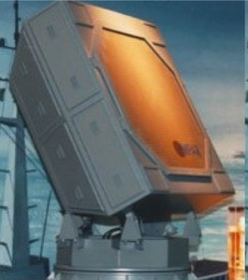
X Band Radar for collision avoidance, costal surveillance and slow moving objects detection.

Two panels of 64 RX/TX elementary modules in grops of four are standard.
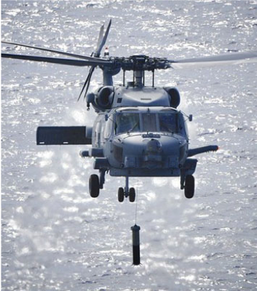
Project Finance Award for collision avoidance Radar development
